PAMARCMiP 2018
Polar Airborne Measurements and Arctic Regional Climate Model Simulation Project
March 10 to April 08 2018, Villum Station/Greenland
The general goal of PAMARCMiP is to obtain a comprehensive data set of atmospheric and sea ice properties that will be used to understand and quantify the interaction between atmospheric aerosol, surface optical properties, and clouds in the central Arctic.
Strategy
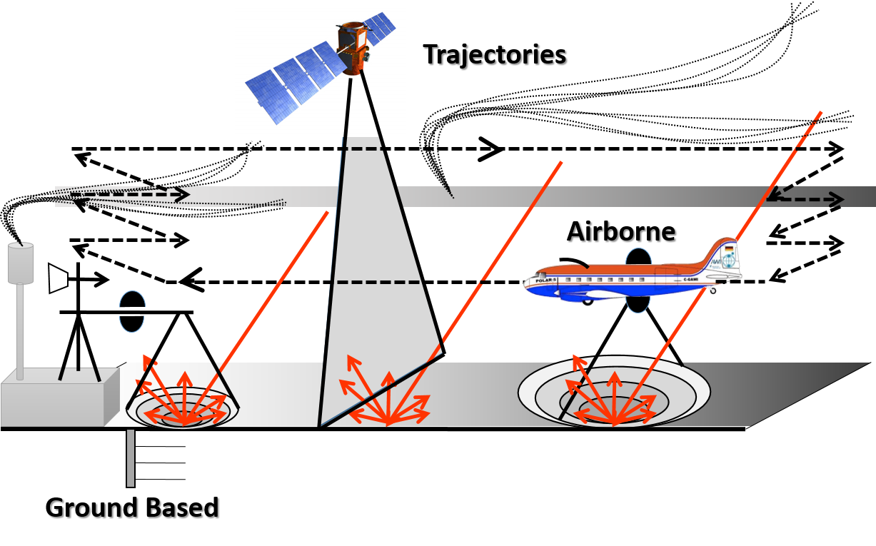
PAMARCMiP combines ground-based stationary and mobile measurements at and in vicinity of the Villum Research Station (Greenland), airborne measurements by the Polar 5 research aircraft, and profiling the atmosphere by tethered-balloon observations. Ground-based activities start from 10. March 2018 and end on 8. April. The Polar 5 aircraft joins one week later from 17. March. While the stationary ground-based observations aim to characterize the temporal evolution of aerosol properties, mobile observations using sledges collect snow samples and chracterize the optical properties of the snow surface on smaller horizontal scales. The airborne observations are used to cover larger scales and the vertical profiles of the atmosphere. Both will be linked by thethered balloon and UAV measurements in the lower atmosphere.
Objectives
PAMARCMiP aims to characterize the short-term variability, horizontal and vertical distribution of aerosols and black carbon (BC) in the atmosphere and concentrations of BC in snow. Quantifying the distribution of aerosols and BC within the Arctic Atmospheric Boundary Layer (ABL), we aim to estimate deposition rates (wet and dry) of aerosols as well as source regions and the physical/chemical state of the observed BC-containing aerosol. The analyses of both will be used to link the atmospheric BC to the BC in snow on the ground and help to quantify the radiative forcing of BC on the Arctic surface layer. Changes of the surface radiation budget for aerosols originating from long-range transport of anthropogenic and natural and local emitted anthropogenic aerosol will be analyzed.
Simultaneously, the physical and optical properties of sea ice and snow will be measured (airborne and ground-based). Snow optical properties such as spectral albedo and bidirectional reflectance distribution function (BRDF) will be derived and analyzed in dependence of BC concentrations, snow grain size, surface roughness and the variability of snow and sea ice thickness. The correlation between snow albedo changes and absorptive properties of BC will be evaluated.
The measured spatial and spectral distribution of BRDFs / surface albedo will serve as input for 3D radiative transfer (RT) simulations to quantify 3D radiative effects and their sensitivity on the retrieval of cloud and aerosol properties as well as the sensitivity on the radiative cooling or warming by Arctic clouds which in turn influences feedback mechanisms within the Arctic Amplification.
Measurements of cloud properties will be conducted on the Polar 5 aircraft in cloudy situations. The characterization of cloud macro-and microphysical properties will be used to interpret the aerosol and surface properties in terms of wet deposition, cloud-aerosol interaction, and 3D radiative effects. The cloud radiative forcing will be quantified for a representative area of heterogeneous surfaces in terms of their spectral and spatial variability. The in-situ cloud and aerosol properties will be compared with satellite observations in order to estimate the impact of surface heterogeneities on the retrieval uncertainty of Arctic cloud and aerosol properties.
The tethered balloon platforms will be used to link local ground-based and airborne observations. Profiling the cloudy and cloud-free atmospheric boundary layer, the atmospheric state, turbulent and radiative fluxes, and aerosol concentration throughout the lower atmosphere will be measured to quantify the interaction between the surface layer and free atmosphere.
Location
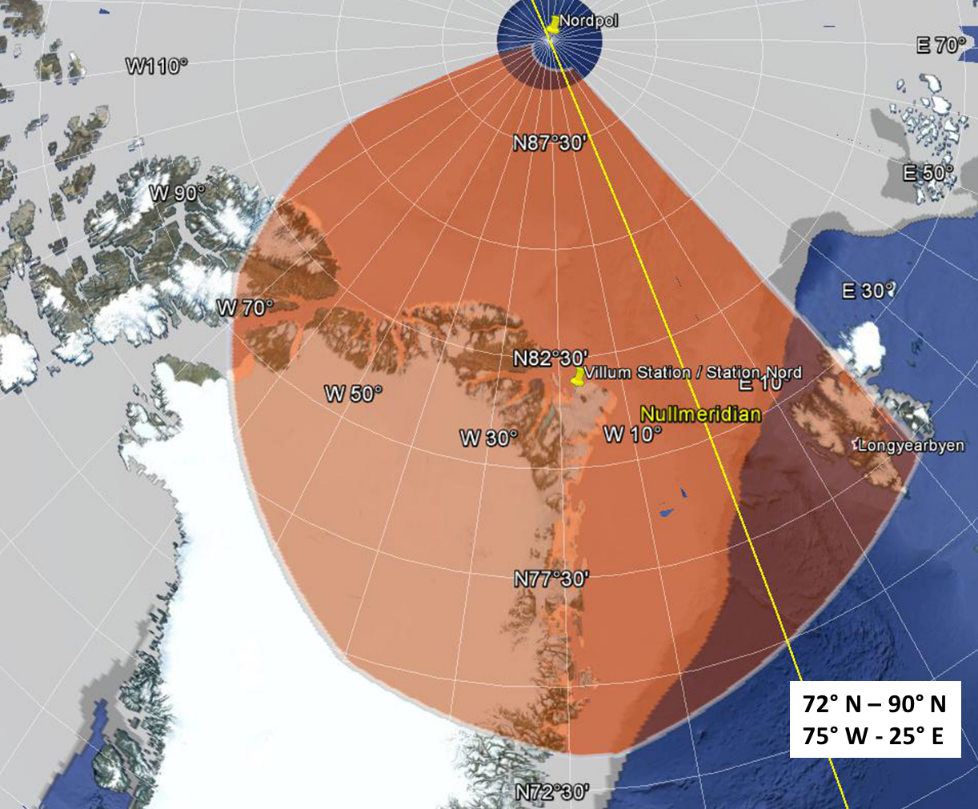
Ground-based observations will be based at Villum Research Station (Greenland). The operation area of Polar 5 will be mainly above sea ice in the Arctic sea and the Fram Strait. While dense multi-year sea ice is expected north of Greenland, thinner first year sea ice will dominate the sea ice in the Fram Strait. Some flights will focus on the snow properties over the Greenland to be able to compare to the ground-based observations around Villum Research Station.

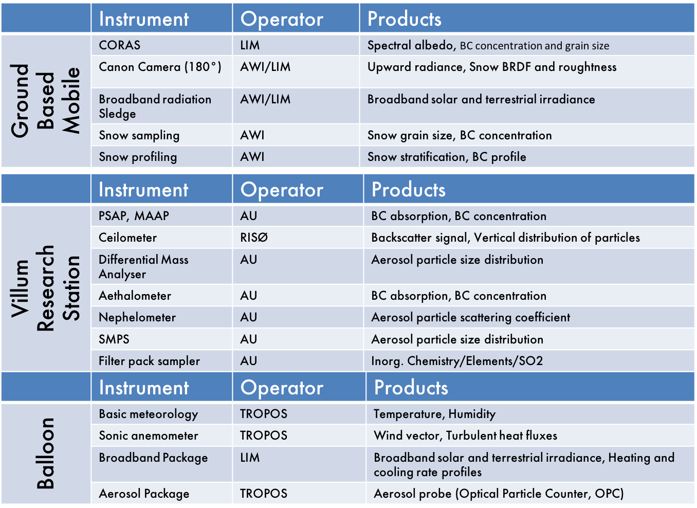
Ground-Based Instrumentation
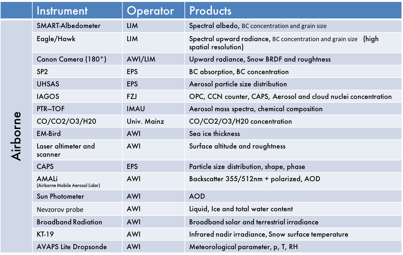
Polar 5 – Airborne Instrumentation
Time to go until first flight day of ACLOUD
- days
- hours
- minutes
- seconds
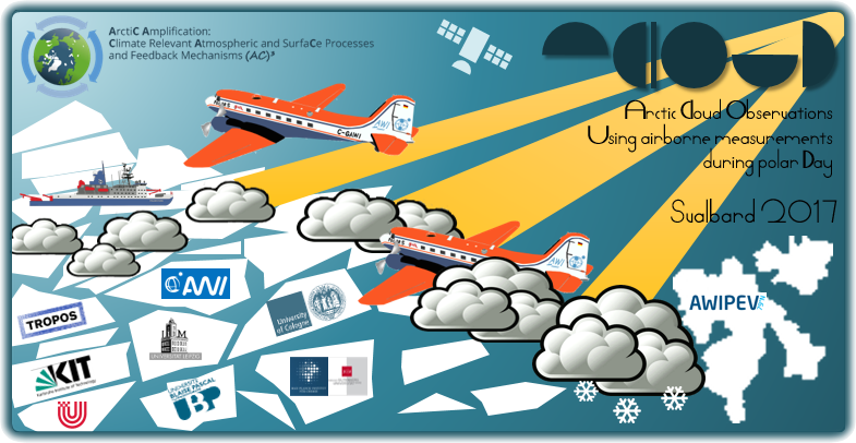
ACLOUD is a joint project of different German universities and research institutes embedded in the Transregional Collaborative Research Centre TR 172: ArctiC Amplification: Climate Relevant Atmospheric and SurfaCe Processes, and Feedback Mechanisms (AC)³. The general goal of ACLOUD is to obtain a comprehensive data set of a diversity of atmospheric parameters that will be used to understand and quantify specific physical processes in, above, and below Arctic clouds. The analysis of the measurement data will, in combination with different kinds of atmospheric models, be used to estimate the role of Arctic clouds for the amplified climate change in Polar Regions.
Strategy
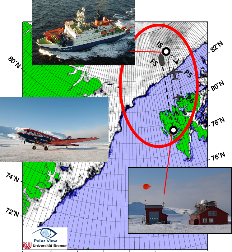
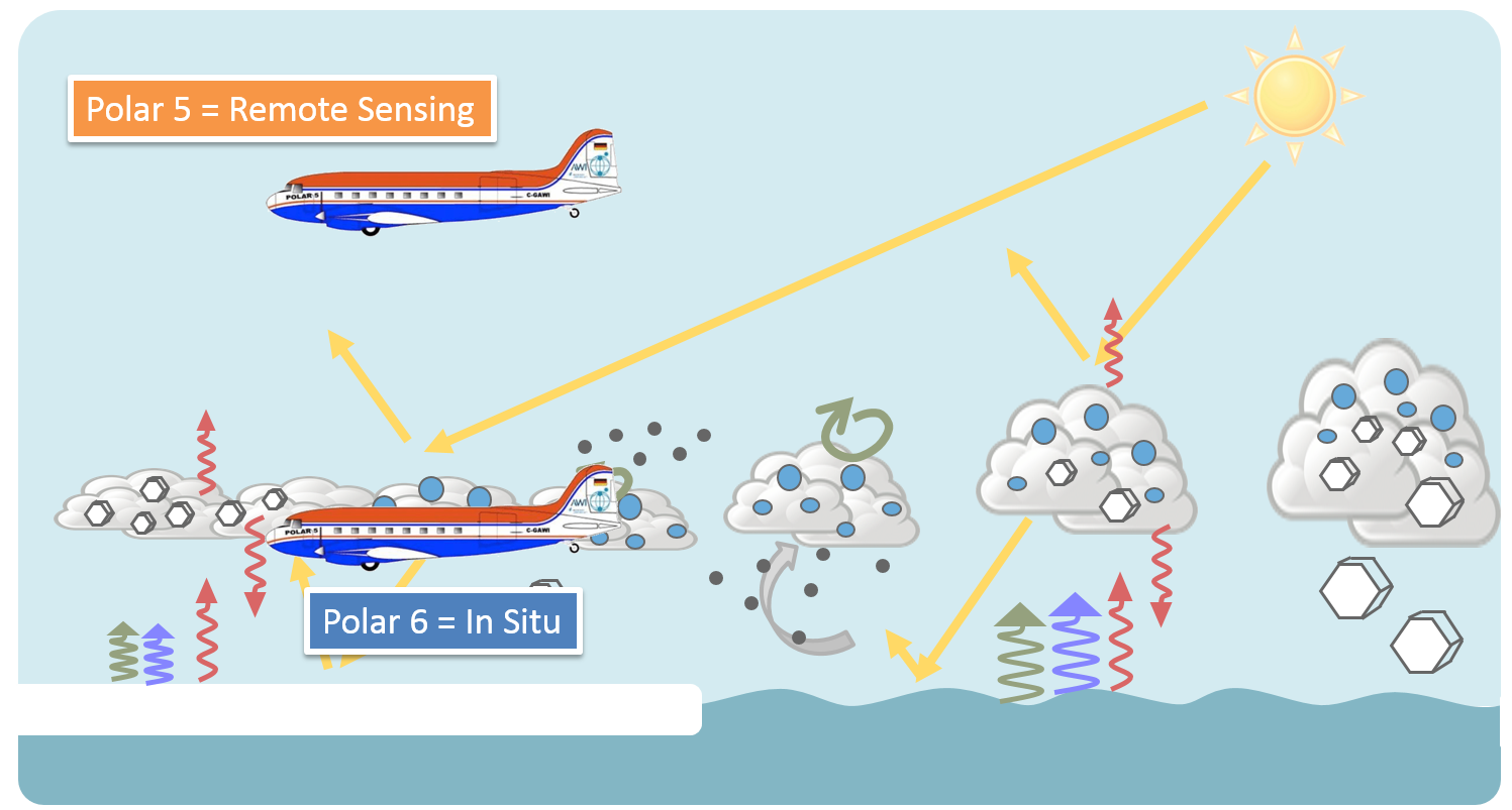
ACLOUD employs two research aircraft, Polar 5 & 6, operated by the Alfred Wegener Institute for Marine and Polar research. The research flights aim to measure properties of cloud and aerosol particles, trace gas concentration, the energy fluxes in the atmospheric column including radiative fluxes as well as fluxes of sensible and turbulent latent heat. In situ measurement techniques and remote sensing instruments will be applied. The flights will be performed simultaneously with both aircraft. In total, 80 flight hours for each aircraft within 5 1/2 weeks (22. May – 28. June 2017) are planned. Polar 5 & 6 will approach the ice-pack mainly in altitudes of 3,000 m (10,000 ft). Then flights will be performed in different levels above, in and below clouds if visibility conditions are sufficient. The lowest possible flight level is at 60 m (200 ft) above ground which is needed to characterize turbulent fluxes in the lower part of the atmospheric boundary layer and the surface reflectivity. The base for the aircraft operation will be Longyearbyen, (Svalbard lufthavn, LYR). The airborne observations will be closely coordinated with surface based observations at the AWIPEV station (Ny Ålesund) and with surface based observations from an ice camp around RV Polarstern that will be drifting in sea ice north of Svalbard during the period of the aircraft campaign. Some flights will be performed also while the ship is sailing in the Fram Strait along its way to the final position in the ice pack.
Objectives
The research activities of ACLOUD combine investigations of clouds, atmospheric aerosol, trace gases, and of turbulent and radiative fluxes in cloudy and clear-sky conditions. The main aim of the cloud studies is to improve the understanding of the cloud-related processes in the Arctic atmosphere and to obtain data which can be used for testing the performance atmospheric models in the Arctic ranging from small-scale (LES) to regional and global climate models. Data will be used also for a test of parameterizations (e.g. radiation and turbulence). ACLOUD will characterize the cloud microphysical properties (cloud particle size, concentration, thermodynamic phase and shape), cloud radiative properties and aerosol properties to estimate the impact of cloud-aerosol interactions on the characteristics of the clouds. ACLOUD will focus on low level clouds within the lowest 10,000 ft of the atmosphere and especially on the atmospheric boundary layer clouds. These clouds strongly interact with the Arctic surface and potentially change the surface energy budget in sea ice and ice free areas. Therefore, ACLOUD aims to characterize cloud-surface interaction including turbulent and radiative fluxes, precipitation of snow and rain.
Location
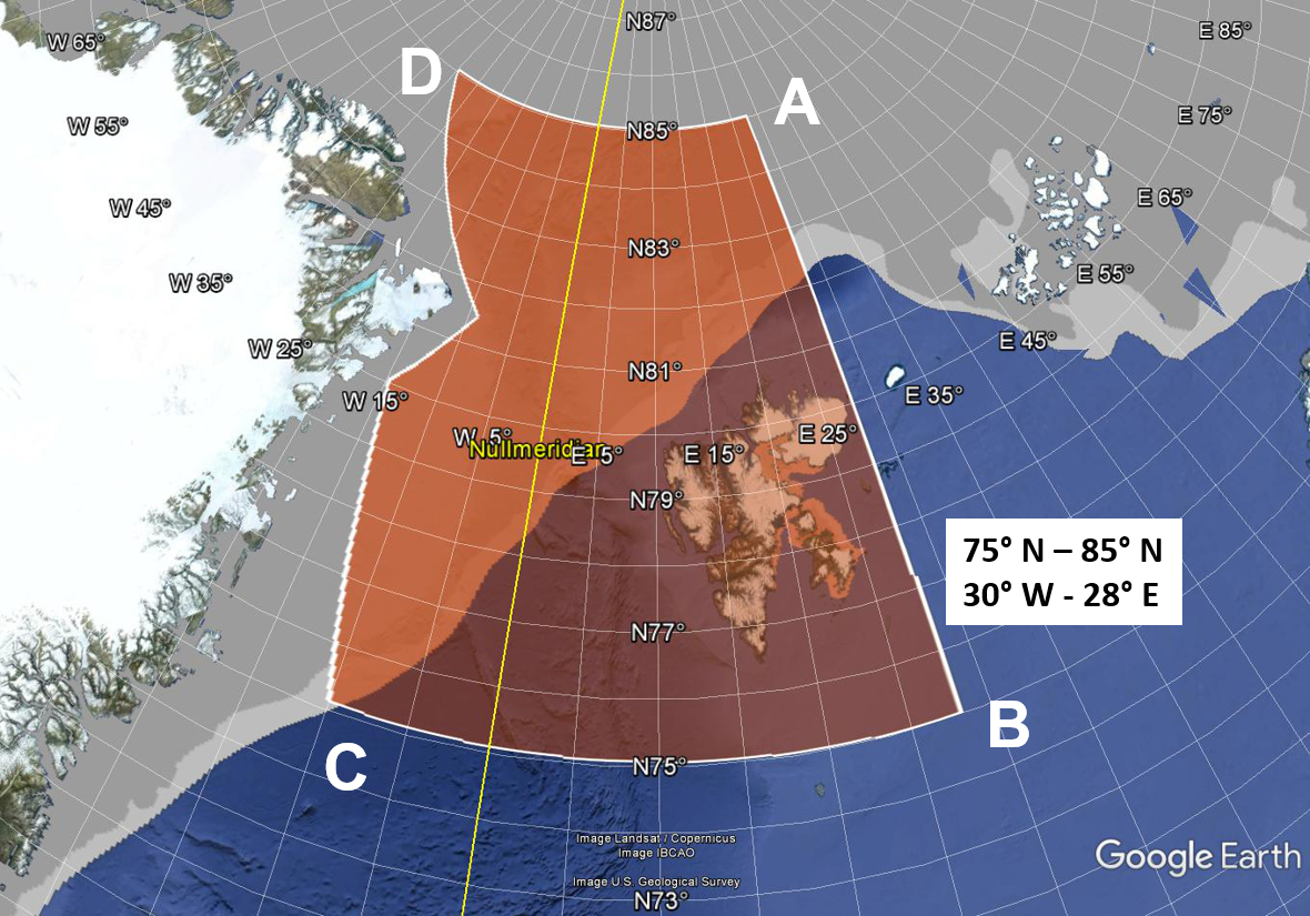
The operation area of Polar 5 & 6 will be adjusted to the position of Polarstern. Polarstern is expected to sail along the west coast of Svalbard north into the sea ice. The ice station is supposed to be initially at about 82.5° N and 15° E and is expected to drift towards south-west. The Polar 5 and Polar 6 aircraft will perform multiple science flights in a sector between 75-85°N and 30°W-28°E.

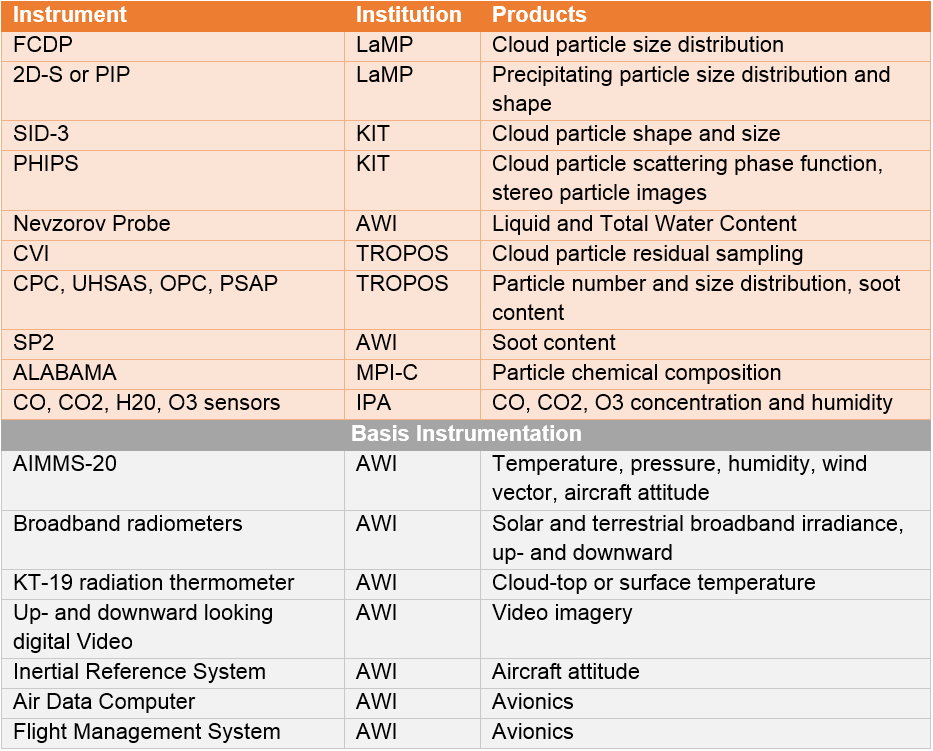
Polar 6 – In situ measurements
Polar 5 – Remote Sensing
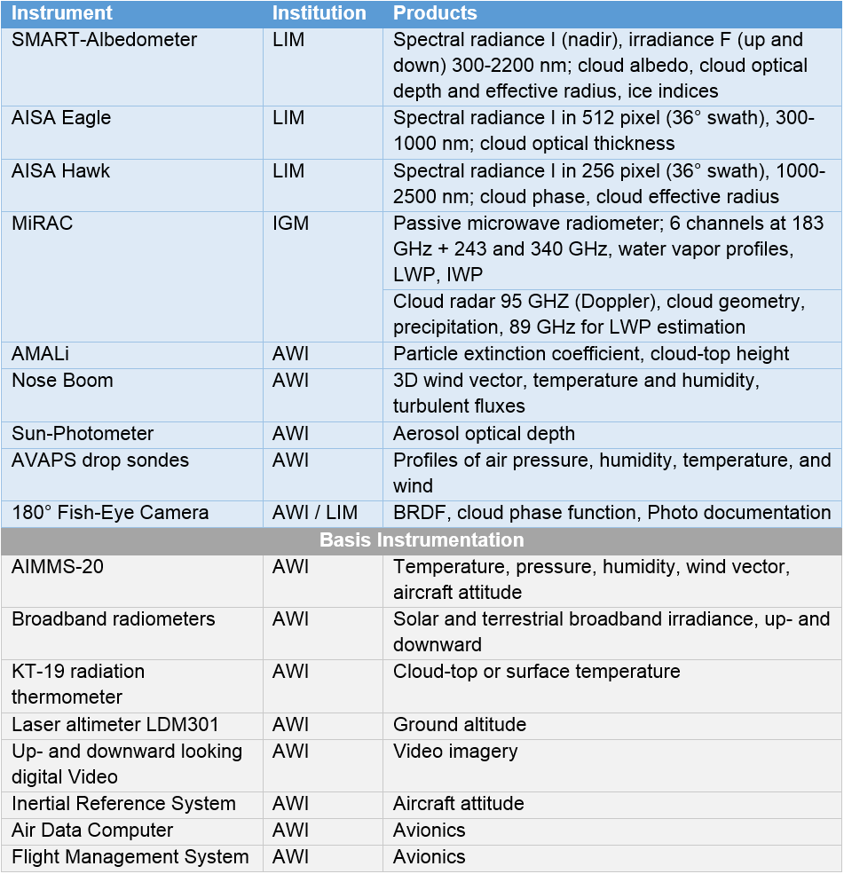

Polar 5 Instrumentation
| Instrument | Institution | Products |
|---|---|---|
| SMART-Albedometer | Spectral radiance I (nadir), irradiance F (up and down) 300-2200 nm; cloud albedo, cloud optical depth and effective radius, ice indices | |
| AISA Eagle | Spectral radiance I in 512 pixel (36° swath), 300-1000 nm; cloud optical thickness | |
| AISA Hawk |  |
Spectral radiance I in 256 pixel (36° swath), 1000-2500 nm; cloud phase, cloud effective radius |
| MiRAC |  |
Passive microwave radiometer; 6 channels at 183 GHz + 243 and 340 GHz, water vapor profiles, LWP, IWP Cloud radar 95 GHZ (Doppler), cloud geometry, precipitation, 89 GHz for LWP estimation |
| AMALi |  |
Particle extinction coefficient, cloud-top height |
| Nose Boom |  |
3D wind vector, temperature and humidity, turbulent fluxes |
| Sun-Photometer |  |
Aerosol optical depth |
| 180° Fish-Eye Camera |  |
BRDF, cloud phase function, Photo documentation |
| AVAPS drop sondes |  |
Profiles of air pressure, humidity, temperature, and wind |
2016
The 2nd annual (AC)³ General Assembly (GA) meeting will take place from December 1st to 2nd, 2016 in Potsdam (Germany).
The Early Career Scientist and PIs will present their scientific highlights from the first year. During breakout group discussion, the (AC)³ participants will report and discuss on onging collaborations with other Cluster groups and upcoming campaigns.
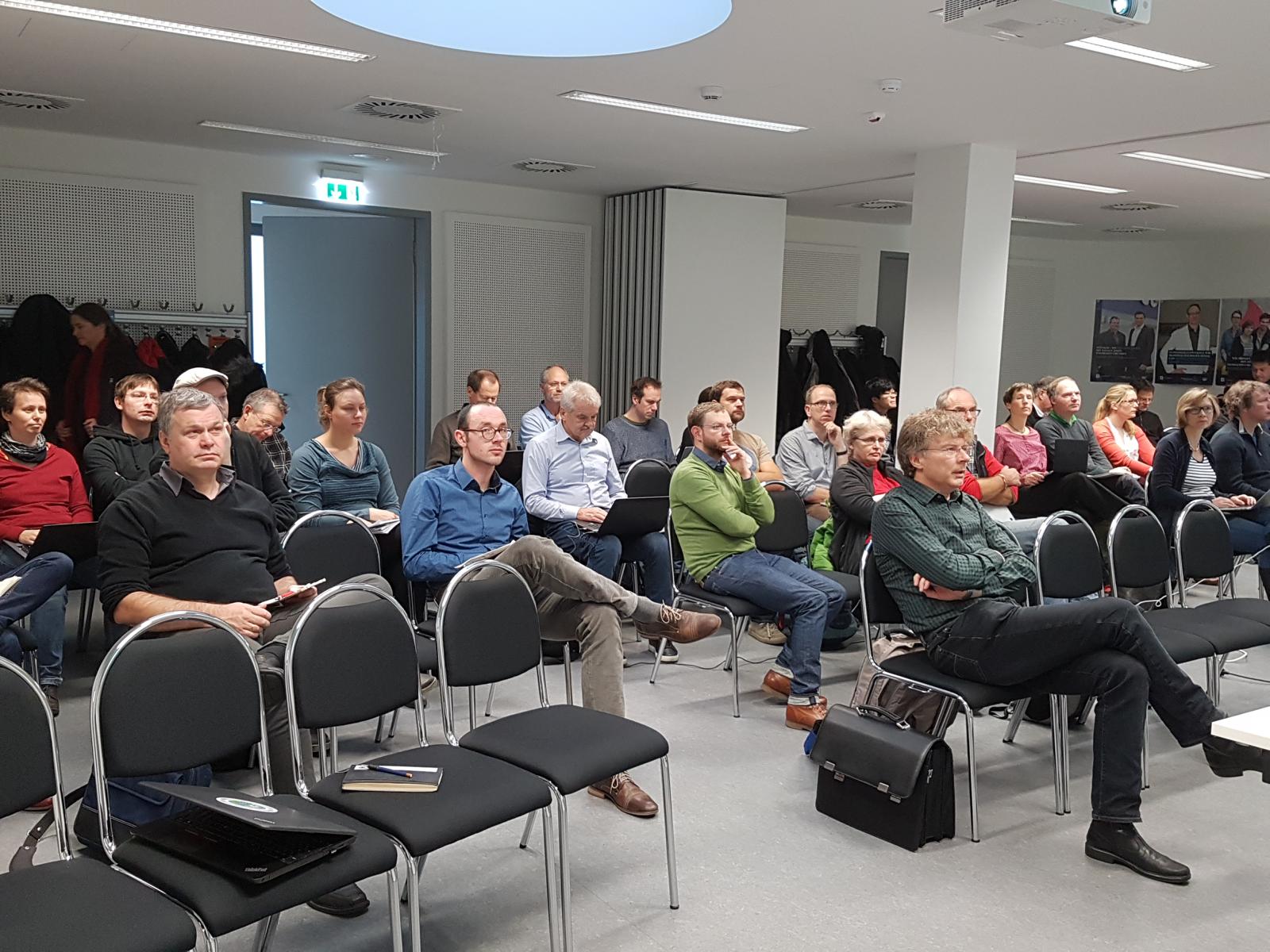
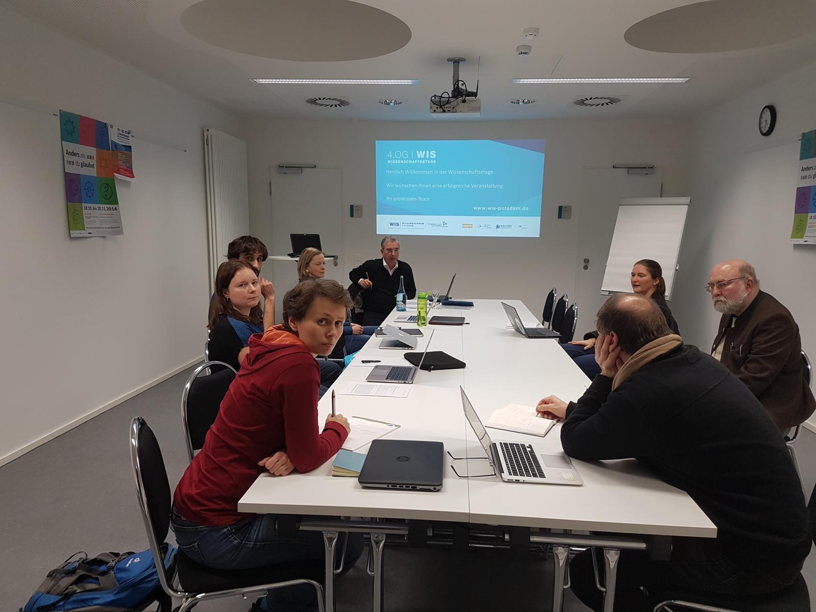
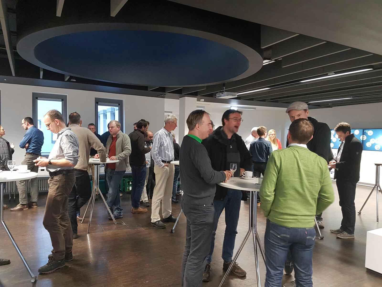
All meeting pdfs can be found in the (AC)³ cloud.
The ACLOUD workshop took place from 21st to 22nd of November, 2016 in Bremen (Germany).
The ACLOUD campaign will take place from May 22nd to June 28th, 2017. The AWI Polar 5 and Polar 6 research aircrafts will be deployed in Ny-Ålesund.
In order to prepare this measurement campaign, about 30 researchers from Germany (University of Leipzig, University of Köln, University of Bremen, University of Mainz, AWI, TROPOS), and France (OPGC University) took part in the workshop. Most of the participants are key international ACLOUD PIs, aircraft instrument scientists and (AC)³ researchers who will all actively take part in the ACLOUD campaign or use the data for their research.
The following items have been discussed during the workshop:
- presentation of science questions and discussion of case studies
- refining flight strategies
- discussion about the ACLOUD procedures, the work plan and the interface between the different groups (instruments, flight facility, flight planning)
- presenting the local infrastructure in Ny-Ålesund
- discussion about a common visualization domain and a common projection
The many lively discussions between theoretical meteorologists, instrument scientists, pilots and students taking part in the campaign made this workshop a successful meeting.
All meeting pdfs can be found in the (AC)³ cloud.
The PAMARCMiP kick-off meeting of (AC)³ took place from October 18th to October 19th, 2016 in Bremen (Germany).
Among the participants were 3 PIs, 6 Postdocs, 2 PhDs and 6 scientist from the participating (AC)³ institutes and partners from the Department of Environmental Science (ATPRO), University of Tokio (EPS), Niiggata University, and the University of Mainz (IPA).
The meeting has been the occasion to get to plan the aircraft campaign PAMARCMIP in spring or early summer 2018 from Station Nord, and to start collaborations within projects, between research areas and with the external partners.
PAMARCMiP Agenda and time schedule (PDF).
Further information can be found in the intranet.
All meeting pdfs can be found in the (AC)³ cloud.
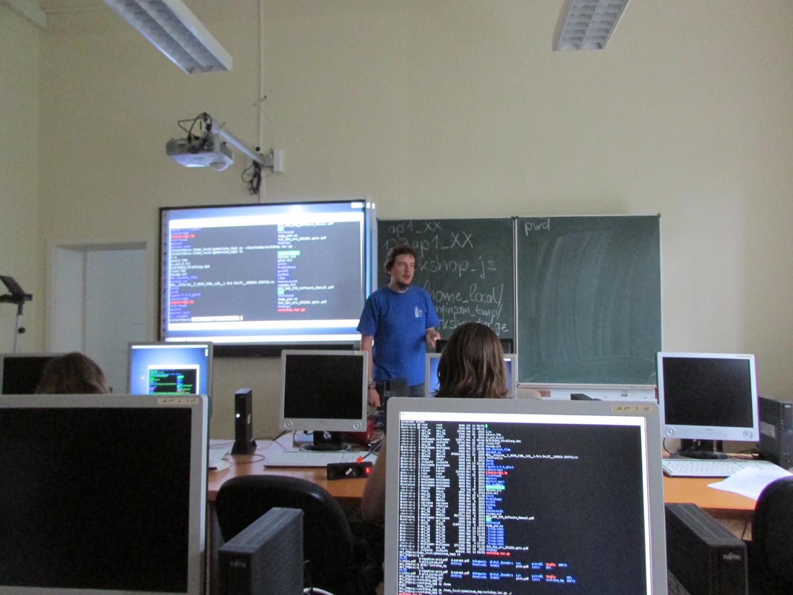
PhD Workshop: An Introduction into Linux/Unix and Programming with FORTRAN 14. – 17.07.16 in Leipzig
When interacting with a server or computing cluster, the use of the command line (e.g. the Lunix terminal) is essential. Many of these servers are using a Linux system, or a system that can be handled in a similar way and are not accessible with a graphical user interface (GUI). The knowledge about the functions ot the terminal will make it a powerful tool for everyda work, not only when interacting with computing centres but also with peronal Linux/Unix machines.
FORTRAN is still one of the most commonly used programming languages in the field of meteorology/climatology. Its performance makes it useful for modelling as well as for data handling and analysis.
This workshop will give a short introduction into theses fields through exercises and coaching. It will be held by PhD students who are experienced users.
The workshop is capped at 14 participants for room capacity reasons.
The Kick-off PhD meeting of (AC)³ tooks place from June 1st to June 2nd, 2016 at Kloster Nimbschen, Grimma (Germany).
This meeting is for the (AC)³ PhDs to organize themselves and to improve their collaboration and productivity between the different locations.
The program of the PhD Kick-off meeting and additional information is available here. (PDF)
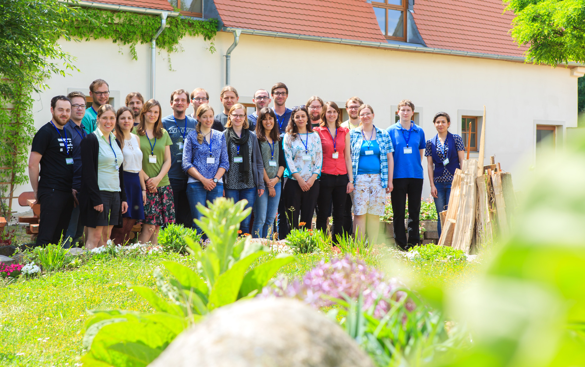
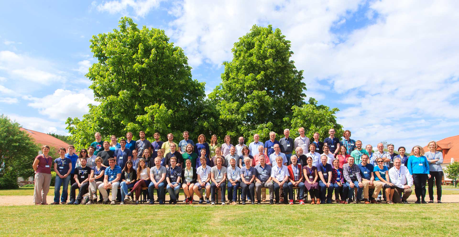
The Kick-off meeting of (AC)³ tooks place from May 30th to June 1st, 2016 at Kloster Nimbschen, Grimma (Germany).
The meeting had the occasion to get to know each other and to start collaborations within projects, between research areas and with the international guests.
The program of the Kick-off meeting and additional information is available here.
Further information can be found in the intranet.
All meeting pdfs can be found in the (AC)³ cloud.
The ACLOUD meeting of (AC)³ took place from February 16th to February 17th, 2016 in Leipzig (Germany).
Among the participants were 6 PIs, 3 PhDs and 13 scientist from the participating (AC)³ institutes and partners from the University of Mainz (IPA), Max-Planck-Institute Mainz (MPI), and the Karlsruher Institute for Technology (KIT).
The meeting has been the occasion to get to plan the aircraft campaign ACLOUD from 22 May – 28 June 2017 in Longyearbyen, Svalbard, and to start collaborations within projects, between research areas and with the external partners.
All meeting pdfs can be found in the (AC)³ cloud.
Schedule of field observations, planned in Phase I of (AC)³. CONCORD: Continuous characterization of the Ny–Ålesund column and radiative effects from ground–based remote sensing; PASCAL: Physical feedback of Arctic ABL, Sea ice, Cloud and Aerosol; ABEX: Arctic Balloon–borne profiling EXperiment; ACLOUD: Arctic Clouds – Characterization of Ice, aerosol Particles and Energy fluxes; PAMARCMiP: Polar Airborne Measurements and Arctic Regional Climate Model Simulation Project; AFLUX: Arctic Amplification: Fluxes in the Cloudy Atmospheric Boundary Layer; MOSAiC: Multidisciplinary drifting Observatory for the Study of Arctic Climate. The colouring is defined as follows: yellow: ground–based; blue: ship–based; red: tethered balloon; green: aircraft; gray: space–borne.
Schedule of field observations, planned in Phase I of (AC)³. CONCORD: Continuous characterization of the Ny–Ålesund column and radiative effects from ground–based remote sensing; PASCAL: Physical feedback of Arctic ABL, Sea ice, Cloud and Aerosol; ABEX: Arctic Balloon–borne profiling EXperiment; ACLOUD: Arctic Clouds – Characterization of Ice, aerosol Particles and Energy fluxes; PAMARCMiP: Polar Airborne Measurements and Arctic Regional Climate Model Simulation Project; AFLUX: Arctic Amplification: Fluxes in the Cloudy Atmospheric Boundary Layer; MOSAiC: Multidisciplinary drifting Observatory for the Study of Arctic Climate. The colouring is defined as follows: yellow: ground–based; blue: ship–based; red: tethered balloon; green: aircraft; gray: space–borne.

